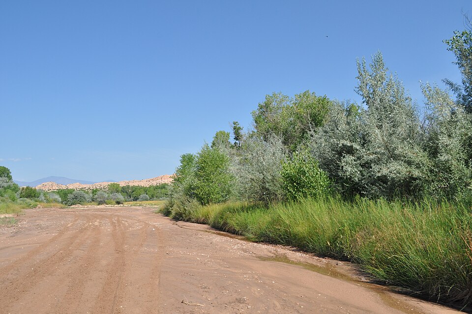
Rio Tesuque looking east at Pojoaque, August 9, 2012National Trails Office, National Park Service / National Park Service, NPGallery 02ffbaae-1f80-4eb5-a7b0-4dc16ed106c4, via Wikimedia Commons · Public domain — item-specific U.S. government/NPS designation
Tesuque Pueblo is a Tewa-speaking community whose own history connects people, farming and the Rio Tesuque. Read that account alongside an attributed environmental profile about water scarcity, riparian work and fire management, while keeping the dates and limits of each source in view.
See each region’s evidence for historical or present-day scope.
Homeland / region
Southwest / New Mexico
Research depth
Source guide
Source collection
2 annotated resources · 1 Indigenous-led
Inspected sources
2 substantive works · selected content reviewed
Initial adequacy
Still unfinished
Source review
October 28, 2026
A source guide for a deeper dive.This entry provides a brief orientation and an organized reading path. A comprehensive deep dive has not yet been completed. Follow the annotated sources and distinguish primary community accounts from outside reference material.
Still unfinished
A bounded actual-content starting path and specifically scoped credited picture are available. Fuller history, source comparison and community review remain open; quantity does not establish completion.
Assessment recorded October 28, 2026. This is separate from research completion and community review.
Still unfinished: a fuller Tewa/Pueblo-authored historical bibliography and more recent environmental accounts remain useful.
Current programme status and measured environmental outcomes are unverified.
The selected Rio Tesuque image is downstream at Pojoaque, not a photograph of Tesuque Pueblo or its reservation.
Backdrop photographs & credits
These photographs have individual, documented connections to this entry. Their captions and source records define the people, place, object, and period shown; no one photograph represents every community within a broader label.
Rio Tesuque looking east at Pojoaque, August 9, 2012 National Trails Office, National Park Service / National Park Service, NPGallery 02ffbaae-1f80-4eb5-a7b0-4dc16ed106c4, via Wikimedia Commons · Public domain — item-specific U.S. government/NPS designation
The specifically identified Rio Tesuque reach at downstream Pojoaque supplies shared named-waterbody context only. Pueblo history documents the Rio Tesuque connection. This is NOT Tesuque Pueblo, its village, a reservation portrait, another community’s cultural object or a boundary claim. No river-health, restoration-success or photography-access permission is inferred. Complete available retrieved JPEG imported unchanged. Background/card CSS crops and overlays affect presentation; the opened page retains the complete available frame proportionally.
Image, association, and reuse record reviewed 2026-10-28.
Full photographs are displayed proportionally above. A translucent background copy may be cropped by the viewport; it does not replace the complete image or its record.
The visual treatment does not change the research status, evidence, or remaining gaps recorded in this profile.
Start reading here
A short purposeful path through selected actual-content works. Read annotations for community, period and inspection limits; this is not a complete history or community endorsement.
Add an attributed account of water and fire management, retaining its legacy date limits.
These are selected starting points. The full annotated collection, source perspectives, inspection limits and remaining research questions follow below. A starting guide is not an exhaustive history or community endorsement.
01
Identity and context
Tesuque Pueblo is a living Pueblo nation in northern New Mexico.
Focus the next stage of research on: Pueblo-published history, Tewa language context and contemporary community government. The sources below are selected reading paths; their authorship, dates and community scope should guide how they are used.
The Pueblo’s history identifies the Rio Tesuque as an important part of community life and describes farming and artistic work. This is the Pueblo’s account of its own setting, rather than a complete history of every Tewa-speaking community. The page’s undated population figures and uncertain site chronology are not used as current facts.
Environmental work in a dated institutional account
The ITEP profile reports Pueblo staff observations about reduced snow and changing seasonal conditions. It also describes water monitoring, riparian restoration, forest treatment and firewood distribution. These activities belong to an undated legacy account that discusses the 2011 Pacheco fire; their current status and ecological results need further documentation.
Still unfinished: a fuller Tewa/Pueblo-authored historical bibliography and more recent environmental accounts remain useful.
Current programme status and measured environmental outcomes are unverified.
The selected Rio Tesuque image is downstream at Pojoaque, not a photograph of Tesuque Pueblo or its reservation.
Cohort13: selected actual-content reviews preserve their institutional/community scope. Existing source cards are upgraded at the same ID and URL where noted; repeated publications are not globally new works.
Follow the reading path
Sources & further reading
Open any title to read the original source. Annotations explain what each link can help you explore.
No Indigenous-led source is identified in this entry yet. This is a gap in this collection, and does not imply an absence of community knowledge or organization.
The Pueblo’s own history connects a Tewa-speaking community, Rio Tesuque, farming and arts. Its river account is a community perspective on place.
Inspection: Content reviewed for the stated scope
Scope: Actual complete substantive main History body: Tewa-speaking identity, foothill setting, Rio Tesuque and other named streams, agriculture and artists. Opening site chronology and undated statistics were read but are not adopted.
Review recorded: October 28, 2026
Access note: Actual selected public content inspected on 2026-10-28. No access bypass or outreach. Linked media are not cleared by this textual review. Inconsistent or ambiguous founding chronology, undated population/acreage/bird totals and ecological-health claims are not treated as verified current facts. The Pueblo homepage expressly forbids photography at the Pueblo; no village, ceremonial or private-site photograph is used.
A substantial environmental profile draws on Pueblo department staff accounts of changing snow, water monitoring, riparian work and fire management. It is an attributed legacy programme narrative.
Inspection: Content reviewed for the stated scope
Scope: Actual selected complete profile body, ordinary web-reader lines 145–218: staff observations, water monitoring, riparian work, forest treatment, community firewood and the 2011 Pacheco fire account. Author and institutional acknowledgments inspected.
Review recorded: October 28, 2026
Access note: Actual selected public content inspected on 2026-10-28. No access bypass or outreach. Linked media are not cleared by this textual review. Undated legacy account with references to 2010–2011. Observations and programme reports are attributed, not independently verified present conditions or outcomes. Linked plans, measurements and photographs were not independently inspected. Courtesy/all-rights-reserved Pueblo photographs are not reproduced.
Related entries may represent alternate names, constituent communities, wider groupings, or historical connections. Read the naming notes before treating entries as equivalent.
Robey’s Atlas of Indigenous North America · Compiled October 19, 2026 · Tesuque Pueblo